

If you have ever renovated an old building, you already know how often “as-built” drawings turn out to be wrong. Walls shift, pipes get rerouted, and old blueprints stop matching reality. This is the gap that Scan to BIM was built to close.
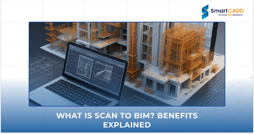
In simple terms, Scan to BIM takes a laser-accurate picture of an existing building and turns it into a smart, editable 3D model that architects, engineers, and contractors can trust.
Here is how the process actually works, step by step.
What is Scan to BIM?
Defining Scan to BIM
Scan to BIM is the process of scanning a physical space with a 3D laser scanner and converting that scan into a Building Information Model. Think of it as reverse engineering a building: instead of designing something new on paper, you capture what already exists and rebuild it digitally, element by element, in software like Revit.
The result is a model that reflects the true dimensions and conditions of the site, not just what the original drawings claimed.
What is a Point Cloud?
A point cloud is the raw output of a 3D laser scan: a massive collection of individual points, each with its own X, Y, and Z coordinates, that together map out every surface in a space, walls, ceilings, ducts, columns, and furniture included.
On its own, a point cloud looks like a dense, ghostly outline of a building. It isn’t usable for design work until it’s cleaned up and converted into real building elements, a conversion known as point cloud to BIM.
Who Uses Laser Scan to BIM Services and Why?
Architects, MEP engineers, structural consultants, facility managers, and general contractors all rely on laser scan to BIM services. Architects use it to plan renovations accurately, MEP teams use it to avoid clashes with existing pipework, and facility managers use it to build a digital twin for long-term maintenance.
Essentially, anyone who needs to know what a building looks like today, not decades ago, benefits from this process.
Step-by-Step: How Does the Laser Scan to BIM Process Work?
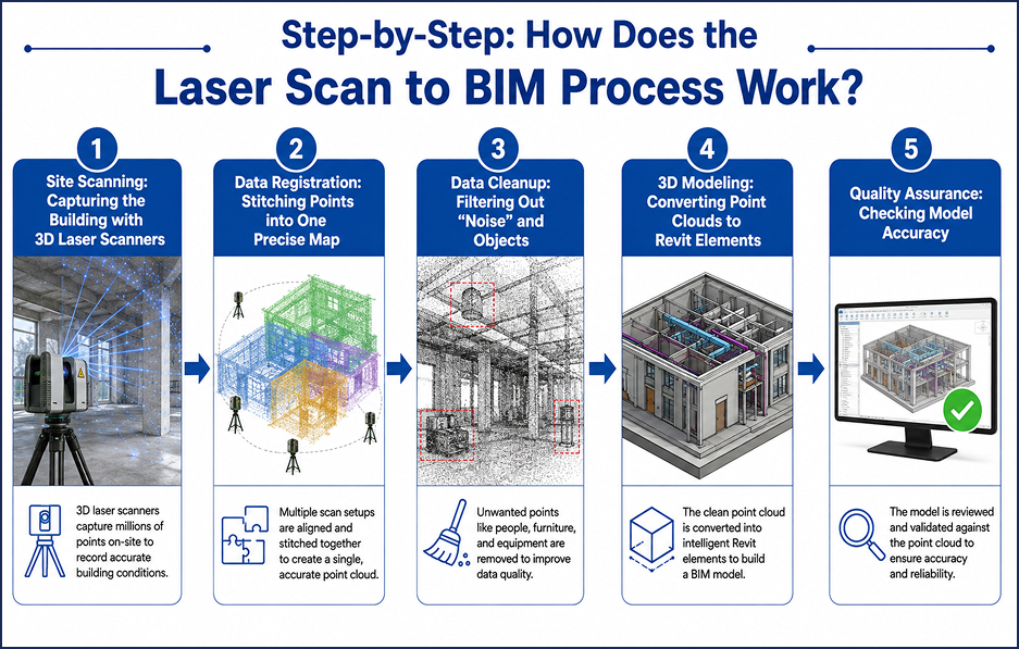
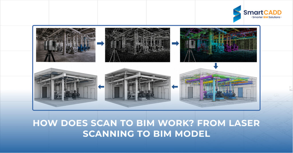
Step 1 – Site Scanning: Capturing the Building with 3D Laser Scanners
The process begins on-site with a 3D laser scanner, which sends out thousands of laser pulses per second and measures how long each one takes to bounce back. This plots millions of precise points, capturing the exact geometry of walls, floors, equipment, and structural elements. Multiple scan positions are taken throughout the building to cover every corner without blind spots.
In practice, scan planning also has to account for real-world obstacles. Reflective surfaces like glass and polished metal can scatter the laser and create gaps, so experienced scanning teams add extra setup positions around these areas rather than relying on a standard grid.
Step 2 – Data Registration: Stitching Points into One Precise Map
Each scan position produces its own point cloud, and these individual scans need to be stitched together into one unified model. This step, called registration, aligns all the scans using shared reference points, so the building is represented as one continuous, accurate dataset.
Step 3 – Data Cleanup: Filtering Out “Noise” and Objects
Raw scans pick up everything in their path, including furniture, people, and reflections, which show up as unwanted “noise.” Technicians clean this up by removing clutter and isolating the architectural, structural, and MEP elements that actually matter for modeling.
Step 4 – 3D Modeling: Converting Point Clouds to Revit Elements
Here’s where the real transformation happens. Using the cleaned point cloud as a reference layer, modelers rebuild the space in Revit, converting scanned surfaces into intelligent walls, floors, beams, columns, ducts, and pipes. This scan to BIM Revit process turns a static point cloud into a fully parametric, editable model.
Step 5 – Quality Assurance: Checking Model Accuracy
Before delivery, the finished model is checked against the original point cloud to confirm dimensional accuracy, usually down to a few millimeters.
Most professional teams benchmark this accuracy against recognized frameworks such as the USIBD Level of Accuracy (LOA) specification, which sets clear tolerance ranges for as-built documentation. So clients aren’t just told a model is “accurate” but can see it measured against an industry-defined standard.
This QA step ensures the deliverable is not just visually correct but genuinely reliable for design decisions.
Key Benefits of Using Laser Scan to BIM Services
Eliminates Human Error and Site Re-visits
Manual measurements are slow and prone to mistakes. A single scan captures everything at once, cutting down on repeated site visits and costly errors.
Early Clash Detection Before Construction Begins
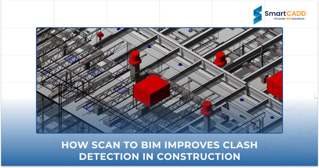
Because the model reflects real conditions, teams can spot clashes between new designs and existing structures before construction starts, saving time and budget.
Faster Project Delivery Timelines
With accurate as-built data available early, design teams spend less time verifying conditions and more time designing, speeding up the overall timeline.
Creates Perfect As-Built Models for Facility Management
Beyond construction, these models become long-term assets for facility managers, supporting maintenance planning and space management for years after the project wraps up.
Where is Scan to BIM Used? Real-World Applications
Historic Restoration and Heritage Buildings
For heritage structures, physical alterations are risky and drawings are often missing or outdated. Scan to BIM Modelling Services let teams document these buildings precisely without touching a single stone.
Commercial Renovations and Fit-Outs
Retail and office fit-outs move fast, and accurate existing-condition data helps design teams avoid surprises once construction begins.
Complex MEP (Mechanical, Electrical, Plumbing) Coordination
In buildings with dense mechanical systems, Point Cloud to BIM data helps engineers coordinate new installations around existing ducts, pipes, and cable trays with confidence.
Infrastructure, Hospitals, and Industrial Facilities
Hospitals, plants, and infrastructure projects often can’t afford downtime for manual surveys. 3D Scanning BIM services capture accurate data quickly, with minimal disruption to operations.
Why Choose SmartCADD for Your Laser Scan to BIM Services?
SmartCADD is a BIM and CAD outsourcing partner serving clients across Australia, New Zealand, the USA, and India. We work with architects, engineers, and contractors who need existing-condition data they can actually rely on, and Scan to BIM is one of our core service lines.
Our modeling teams follow ISO 19650 information management principles and USIBD accuracy benchmarks on every project, so deliverables are held to the same standards our clients’ own QA teams would expect.
Here’s what sets our approach apart.
AI-Powered Workflows for Sub-10mm Accuracy
At SmartCADD, we combine experienced modeling teams with AI-assisted workflows to deliver Scan to BIM Services with sub-10mm accuracy. Every project goes through a structured registration, cleanup, and modeling process, so the final BIM model genuinely matches site conditions.
Complete Multi-Discipline Support: Architecture, Structure, and MEP
We handle architectural, structural, and MEP scope in a single coordinated workflow. Whether you need Scan to BIM Modelling Services for a full building or just the MEP layer, our team builds every discipline to work together in one model.
Tailored Deliverables from LOD 100 to LOD 500 (FM-Ready BIM)
Not every project needs the same level of detail. SmartCADD tailor our Point Cloud Scan to BIM deliverables anywhere from LOD 100 conceptual models to LOD 500 facility-management-ready models, based on what your project actually requires.
Cost-Effective Outsourcing to Global BIM Standards
As a global BIM outsourcing partner, we deliver Scan to BIM Revit models that follow international BIM standards, at a cost structure that makes sense for firms of any size. You can learn more about our services and past project experience at smartcadd.com.
Conclusion: Build Smarter with Digital Twin Accuracy
Scan to BIM has become one of the most practical tools for teams working with existing buildings, turning uncertainty into precise, usable data. From historic restorations to hospital renovations, this process removes the guesswork that has traditionally slowed down construction.
If your next project depends on knowing exactly what’s really there, partnering with a team that understands BIM Point Cloud workflows inside and out can make all the difference.